
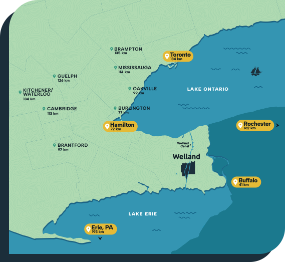
Strategically Located
Welland has close linkages with businesses and markets in nearby Toronto, Hamilton, and Buffalo. Furthermore, the city is within a day’s drive of North America’s largest metro areas and populations:
- New York City: 650km – 19.6 million
- Chicago: 830km – 9.3 million
- Washington DC: 650km – 6.3 million
- Philadelphia: 650km – 6.2 million
- Boston: 770km – 4.9 million
- Detroit-Windsor: 370km – 4.8 million
- Montréal: 675km – 4.6 million
Connected to Everywhere
Welland benefits from an ideal location and leverages an extensive multi-modal transportation network. Welland businesses have access to an unparalleled logistics infrastructure, allowing them to reach their markets easily – whether just up the highway, or around the world.
Air
- Niagara Falls International Airport
- Buffalo Niagara International Airport
- John C. Munro Hamilton International Airport
- Toronto Pearson International Airport
- 2 Regional District Airports
Water
- Great Lakes and St. Lawrence Seaway
- Welland Canal transportation corridor
Rail
- Canadian National
- Canadian Pacific
- Gio Rail Canal Shortline
- GO Train Passenger Rail
Road
- QEW
- Hwy 405
- Hwy 406
- Hwy 420
- Access to 4 international border crossings
A Great Base for Exporters
Niagara was the first region in Ontario to be designated by the federal government as a Foreign Trade Zone (FTZ) Point. The designation reflects the area’s exceptional cluster of logistics and trade-oriented businesses and support experts. Welland companies and suppliers that are involved in production for final export can find and apply for tax, duty and tariff exemptions that can significantly improve their bottom line.
435
Transportation &
logistics businesses
1,175
Million truck
border crossings
$7.3
Billion in
manufacturing exports
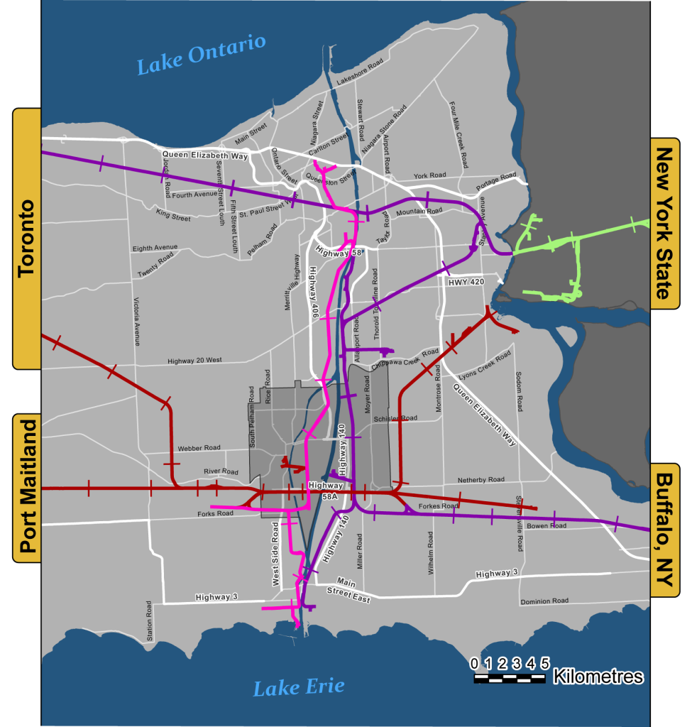
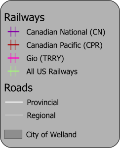
Welland’s Railway Connections
Welland is an excellent railway hub that includes connections to both national railways (CN and CPR), as well as the independent Gio Rail that offers rail transportation and other rail services in the Niagara region. Niagara’s CN lines connect to the U.S. rail network at Niagara Falls NY and Buffalo.
Map Credit: Ry Shissler, GIS Technician/GIS Services
Map Legend
The information contained in this map may represent unintended errors or distortions of fact and the City of Welland (the City) makes no representations or warranties, express or implied, as to the accuracy or completeness of the data and all information should be verified independently. This map is not a legal plan of survey. Depictions of property lines and other features are provided for schematic purposes and should be used for reference only. No part of these drawings, or information, or hard copies made from them may be reproduced and/or distributed without written permission from the City. Copyright © 2025 The Corporation of the City of Welland and its Suppliers. Data sources: City of Welland, Natural Resources Canada, Regional Municipality of Niagara, U.S. Census Bureau, Department of Commerce